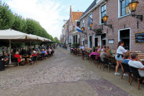
plenty of opportunities for dinner
all 11 cities have a fountain, this one with a girl on the shoulders of a man is called de Kievit (Peewit)
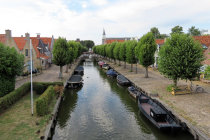
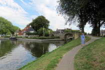
It Djip (the deep) is the canal that cuts the town in two. This is the Dubbelstraat bridge
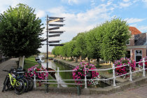
we enter Sleat from the north
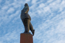
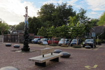
Aukje de reedrydster. All 11 cities feature a statue of a chubby woman on skates, made by E van Hemert
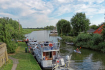
South of town It Djip joins the Sleattermer Gat again
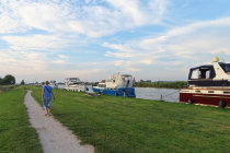
a view north from the Bolwerk South bridge
Windmill de Kaai dates from 1755 and is still in working order
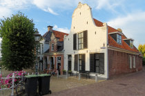
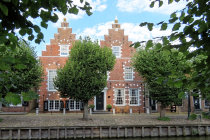
a double stepped gable facade
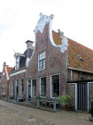
this house from 1721 sports a nice facade
Its origins are lost in
time, but in the 13th century Sleat was a small settlement near a noble family's
stronghold at the strategic junction of
a waterway to the sea and a trade road from Germany.
The place grew in importance and by 1426 Sleat had already secured city rights.
To
keep the Spanish army at bay, a major fortification took place in 1581, just in time to repel a
Spanish attack in 1588.
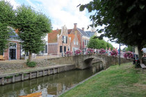
In the 19th
century Sleat prospered from exporting the famous Frisian butter to England, some of that wealth still can be seen from the neck and
stepped gables on the houses along the canal it djip that traverses the city.
Sleat is one of the 11 cities on the route
of the
Alvestêdetocht, the epic 200 km long ice-skating tour that only takes place in extremely cold winters.
Nowadays Sleat
sports a marina and thrives on tourism and water sport.
We visited picturesque Sleat on a warm afternoon in August 2022.
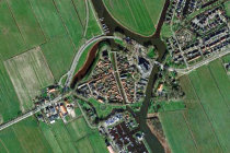
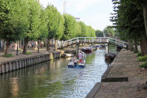


Sleat seen from above, the canal It Djip runs right through it
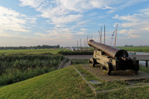
on the northern rampart an old canon covers the Sleattemer Gat, the waterway to the Sleattemer lake
after an interesting visit and a healthy dinner we return to our camping de Jerden