the ENCI factory was decommissioned in 2018
on the trail
from up here there is a great view of Maastricht
a view from the south east side
the fort dates from 1702 but has recently been restored
from Buitengoed Slavante you have a nice view of the Meuse. It is the trail head to the ENCI quarry
the Sint Pietersberg

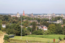
The Sint Pietersberg is the northern stretch of the limestone Caestert Plateau and finds itself sandwiched between the Jeker and Meuse rivers.
In Neolithic times local flint deposits were mined for stone tools and weapons and since the Middle Ages the limestone was quarried for building material and fertilizer. Over time this has created a dense and chaotic network of tunnels and caves. During all that digging, scores of fossils were found like the famous skull of a Mosasaurus in 1765.

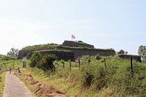
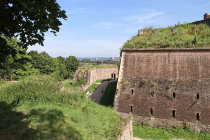
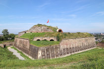
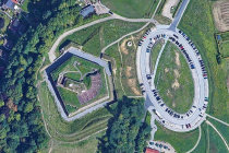
The hill's strategic position was quickly recognized as indicated by the remains of an Iron Age fortress. Fort St Pieter was built in 1702 to defend Maastricht, but in 1794 a large French army took the city anyway.

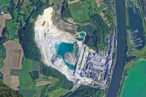
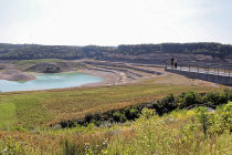
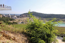
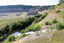
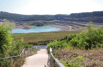
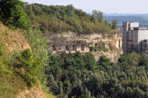
From 1921 till 2018 ENCI operated a large scale surface mining of limestone for cement production. The quarry is now transformed into a nature reserve. An elevated observatory gives a nice view over the quarry and, when lucky, you may spot one of the resident eagle-owls.
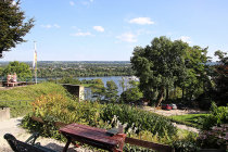
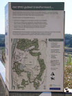
The viewpoint is also the formal end of the 500 km long Pieterpad, the country's longest walking trail.

We visited here in September 2021.


website730055.jpg website730054.jpg website730053.jpg website730052.jpg website730051.jpg website730050.jpg website730049.jpg website730048.jpg website730047.jpg website730046.jpg website730045.jpg website730002.gif website730043.gif website730042.gif
1
2
4
5
6
7
8
9
10
11
end
website730003.gif website730001.gif
a Google maps view of fort Sint Pieter
website730002.gif website730003.gif website730002.gif website730001.gif
we approach fort Sint Pieter from the Maastricht side
3
website730003.gif website730002.gif website730001.gif website730003.gif website730002.gif website730001.gif website730003.gif website730002.gif website730001.gif
the ENCI quarry seen from above, thanks to Google maps
website730003.gif website730002.gif website730001.gif website730003.gif website730002.gif website730001.gif website730003.gif website730002.gif website730001.gif
the viewpoint towers high above the quarry
website730003.gif website730002.gif website730001.gif website730003.gif website730002.gif website730001.gif website730003.gif website730002.gif website730001.gif
a staircase leads you down
website730019.gif website730018.jpg website730017.jpg website730016.jpg website730015.jpg website730014.jpg
the mural says: time only exists because otherwise everything would happen at once
a board explains how the quarry will be transformed into a nature reserve
the old tunnels are exposed as a result of the deep surface mining
dogs are not allowed on the stairs as sheep graze on the steep slope
12
13
14
15
16
website730003.gif website730002.gif website730001.gif website730003.gif website730002.gif website730001.gif website730003.gif website730002.gif website730001.gif website730003.gif website730002.gif website730001.gif
the Pieterpad trail ends here, 490 km from the start. But you can continue to Nice, a mere 2512 km more
website730003.gif website730002.gif website730001.gif