the Bisschopsweg leads to the Munsterse Poort. Both names refer to the failed attack by the Bishop of Munster
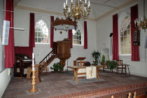
time for a visit to the church
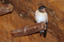
inside the horse mill there is no horse, but this swallow keeps an eye on us
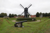
the original windmill is long gone. This copy is from 1980. The gun is original though
renovation works are in progress
in the Kruitstraat they kept the gunpowder ready. In case of an explosion the roof would come of
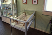
the Tora Scroll in the Synagogue
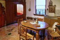
a peek into the Captain's house, including the bedstee (an enclosed bedstead to contain the body heat)
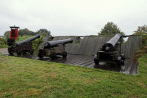
the guns of the Heckmans Bastion shine in the rain. To the left is a sentinel lookout
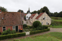
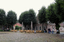
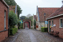
all roads feed to the central Market Square with the age-old lime trees
Boertange
had to wait till 1672 to be really tested during a frontal assault by the forces of the
Prince-Bishop of Munster. The poor bishop
lost and had to retreat.
Over time the fortress lost its significance and in 1851 the military left Boertange to the
civilians to become a rural village.
By 1960 the place was in serious decay and all but deserted. It was
decided to restore the fort to the 1742 heydays and make it a tourist attraction.
Today
Vesting Boertange is exactly
that, with tourist strolling through the small streets and get a feel for how people lived in an 18th century fortress city.
Points
of interest are Central Square, the protestant church, the Synagogue, the Captain's house and the windmill. And do not forget to visit
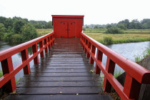
the outhouses over the moat.
We visited Boertange in August 2020. It was pouring cats and dogs...
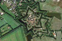


a Google Maps view of Vesting Boertange. Note the pentagon star shape and the moat
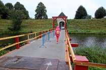
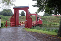
a short walk from the visitor center leads to the bridge over the moat and the northern gate.
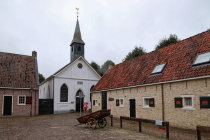
the Kapitein Prottstraat leads you to the white washed protestant church
this version of the church is from 1869, but the pulpit dates back to the 17th century
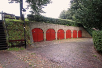
the outhouses over the moat. Just sit down and let it drop...
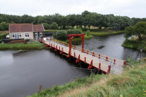
the Munsterse Poort seen from the other side