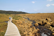
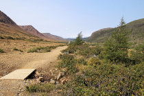
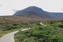
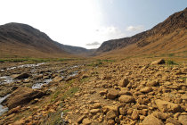
the boardwalk leads into the Winterhouse Brook Canyon
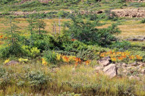
near the streams there are low shrubs and autumn colored ferns
at the end of the trail you can take a rest and enjoy the scene
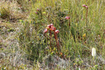
Pitcher Plants only eat insects, we are probably safe.
on the Tablelands Trail
time to return
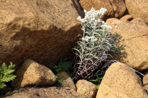
one of the few plants that thrive in this toxic environment
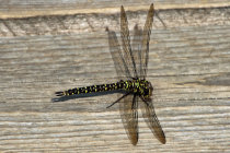
this dragonfly was one of the very few animals we saw,
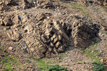
the exposed mantle rock material is called peridotite, the outside is oxidized but inside it has a green color
About 350 million years ago the North American and African
tectonic plates collided and pushed up the ocean floor. The forces
were so strong that a part of the
Earth's mantle was pushed on top of the
Oceanic crust and was deposited at what is now
called the Tablelands.
Subsequent glacial periods further shaped and eroded the area.
A high iron content in the
rocks cause the special ochre-reddish color and since the soil is low on nutrients and high on metals the area resembles a
desert, a great contrast with the rest of Gros Morne Park.
Route 431 from Woody Point to Trout River leads right through the Tablelands.
The
best way to see this unique geology is to put your hikers on and hit the road.
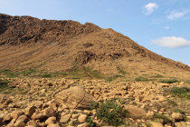
The Tableland Trail is an easy 4 km return hike that
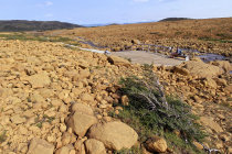
starts at the trailhead off Route 341 and leads you around a mountain into a canyon with a surreal ochre colored rock
field. There is also a small stream here.
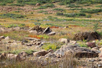
Animals are scarce and only the hardest of plants survive. Lookout for Pitcher
plants.
We hiked the Tableland Trail on a sunny day in September 2017.
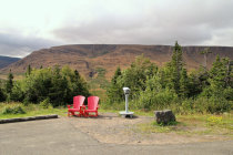


near the trailhead you get a first glimpse of the Tablelands but why are the chairs pointing the other way?
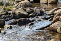
a small stream flows from the mountain
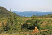
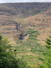
vegitation is scarce in this glacial valley
a glimpse of Bonne Bay
there is a refreshing stream nearby