a flock of sheep is herded down the bare mountain flank
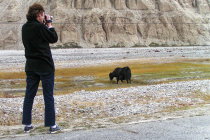
yes, that's a yak
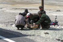
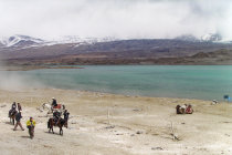
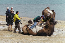
local business men wait for us to offer camelback rides
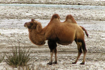
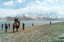
further down the road a camel proudly poses for the picture
roadside entrepreneurs check their merchandise
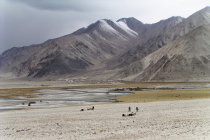
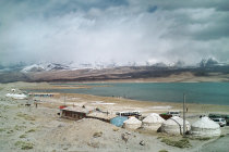
Lake Bulunkou is almost empty but the sand dunes form a nice background
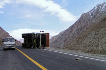
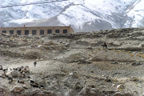
on the way back we pass a toppled truck, this highway is dangerous
these shepherds probably hail from the Kirgiz settlement in the background
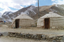
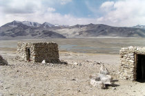
you can spend the night in a real Kirgiz yurt
mounting a camel is easy, it gets tricky when the animal rises to its feet
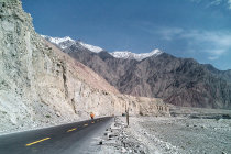
the Karakoram Highway to Karakul Lake
The Karakoram Highway is the world's highest paved international road with a total length of 1300 km and a whopping maximum elevation
of 4714 meters.
The road runs 1300 km and connects Kashgar with Abbottabad way down in Pakistan.
Along the highway there
are really stunning views of the towering and snowcapped Karakoram and
Pamir mountains. Be carefull as you may well
run into roaming
yak and camel.
Some 150 km southwest of Kashgar, the road passes the beautiful Karakul Lake at
an altitude of 3600 meters.
The lake is flanked by snow-capped peaks that easily reach 7500 meter and create
a magnificent backdrop to the azure colored water.
Facilities here are basic, but there is a restaurant and camels are available
for a ride along the lakeshore. For the more adventurous tourists, local Kirgiz folk offer overnight stays in sturdy yurts.
In
October 2003 we drove a small stretch of the Karakoram Highway from Kashgar to Karakul Lake and thoroughly enjoyed the fantastic
views.
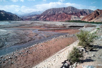


an hour's drive from Kashgar we drive through a colorful scenery at the Gaizi River
soon after we see the first snow-capped peaks
and then the bargaining starts
and then finally we reach Lake Karakul
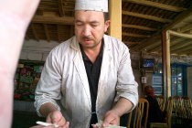
at Oytak we stop for dinner. His coat may be dirty but we liked his the fried chicken
the Muztagh Ata mountain rises to 7500 meters, but today is covered in clouds