a view of Castillon-du-Gard in the far distance
view from above
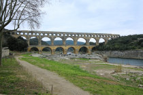
view from the right river bank
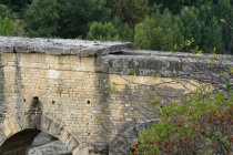
a side bridge was added in 1743, much to the chagrin of Alexandre Dumas
the total lenght was 360 meters with a small slope: the left size is 2.5 cm lower
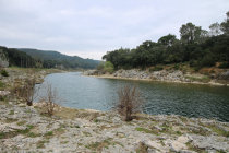
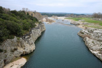
the Gardon river
In the first century AD the roman citizens of Nemausus (present day Nîmes) needed lots of fresh water to drink, bath and operate
their fountains. They found it at la Fontaine de l'Eure near Uzès.
A mainly underground
aquaduct was build with a lenght of 50
km and a total drop of 17 meters. It supplied 2.5 m3 per second to the always thirsty town.
A major challenge was
crossing the gorge of the
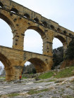
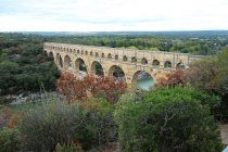
Gardon river near present day Remoulins. Here they build a three layered bridge, the
Pont du
Gard.
It's 49 m high and 360 m long with a drop of only 2.5 cm. The largest span width is 25 meters.
The stones came
from a nearby limestone quarry and were individually cut to fit.
It is a dry wall construction so no morter was used,
gravity and fricton provide sufficient strenght, even after 2000 years.
In the 18th century a major renovation was conducted and a
bridge was added alongside the lower level.
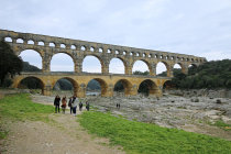
The pont du Gard is a prime example of solid roman engineering.
We
first visited the Pont in March 2015.
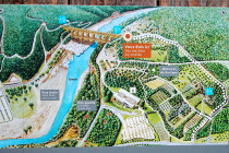


on the left bank there is this plaque with a nice overview of the Pont and its environment
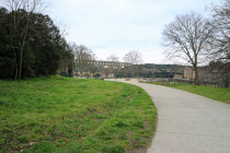
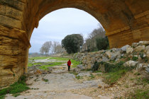
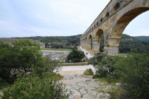
walking on the left riverbank we have a first view of the Pont
all stones were numbered and have inscriptions for the planned location
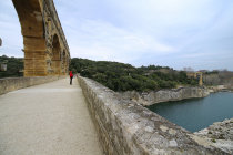
from the bridge you have a nice downstream view
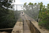

once 2.5 m3 of clear water flowed per second through this channel
for good reasons they have installed a fence on top
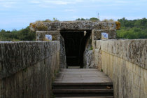
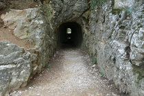
the water continued through this tunnel
most of the slabs that covered the aquaduct are still there
