An hours drive south of Quito is the
Cotopaxi National Park, centered around the
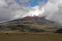
Cotopaxi, Ecuador's 2d largest stratovolcano.
The volcano peaks
at 5897 meters, its summit covered in snow with a real glacier on its flanks.
Cotopaxi is an active volcano that has
destroyed the nearby city of
Latacunga several times, lastly in 1877 when the steaming mudstreams even reached the Pacific
Ocean, 100 km to the west.
Minor eruptions occurred in 2015 and the park was closed for a year.
Despite the danger, climbers flock
to Cotopaxi to scale the icy mountain. Most start early morning from the
Jose F Ribas Refuge at 4800 meters.
Attractions of the
park are the Mariscal Sucre Museum, several lagoons, clear streams and an old Inca fortress.
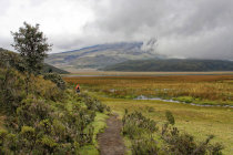
We visited the park on
a rainy day in May 2009 and found Cotopaxi shrouded in clouds. We hiked around the
Limpio Pungo Lake (altitude 3840 m) and had
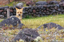
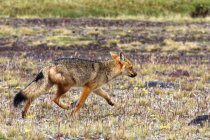
lunch at a typical mountain restaurant where we met a real
Andean Fox.


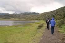
start of the Limpiopungo Lagoon hike
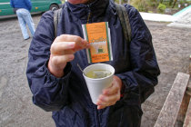
Coca tea may well help against altitude sickness but it tastes terrible
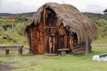
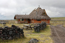
a copy of an original mountain hut
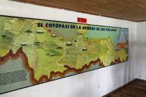
the Mariscal Sucre Museum provides information about the park's geology
an Andean Fox checks us out in the pouring rain
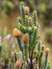
the Chuquirahua thrives at these altitudes


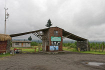
at the park entrance
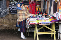
in the nearby souvenir shop the lady carries her child in the traditional way
heading back to the car
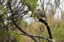
we are being watched
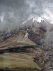
the best shot of the Cotopaxi volcano
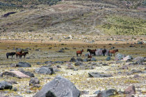
in the higher valleys horses roam free
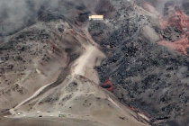
inside the restaurant we have a view of the northern slopes of Cotopaxi
here we will have lunch
and then moves on
the Jose F. Ribas Refuge was hit by an avalanche in 1996, 13 climbers died in the accident