the Governor's House in Saba's capital city the Bottom
the harbor. Before the airport became operational all supplies had to be carried up mountain.
looking down at The Bottom
Locals just call it The Road
 The Road starts at the airport and goes up all the way up to Zion Mountain, and than down to the harbor
time for a drink before the plane arrives
a nice view of the Juancho E. Yrausquin international airport
the Windwardside church
space is scarce, also for your final retirement
  the mural inside the church was created by local artist Heleen Cornet
Saba

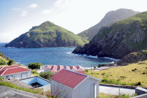
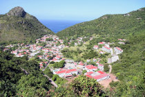
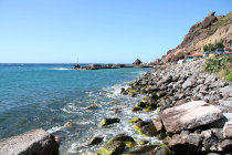
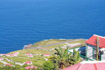
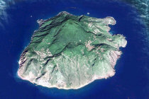
Saba is the top of the stratovolcano Mount Scenery in the Caribbean Sea, just south of St Maarten. With a height of 887 meter the top is the highest point in the Kingdom of the Netherlands.

Cristopher Columbus spotted the island in 1493 but it was 1632 before shipwrecked British sailors set foot ashore here.
In the following centuries the Dutch, Brits, French and even Jamaican Pirates took possession of Saba but since 1816 Saba is firmly in Dutch hands. 
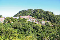
In October 2010 Saba became aspecial municipality within the Netherlands. 

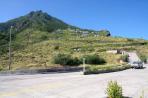
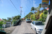
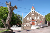
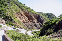
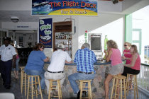
The 2000 citizens are proud of the only paved road on the island, since Dutch engineers said it was impossible to build. But Josephus Hassell rose to the occasion and, with the help of the locals, proved the arrogant engineers wrong. 
It took from 1938 till 1958 to get the 11 km long job done.
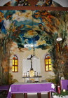
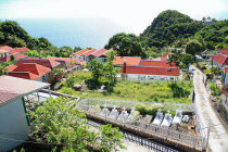
Sabans also cherishThe Saba University School of Medicine, established in 1992. 


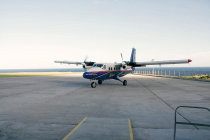
Saba's airport has a runway of just 400 meters, too short for jet airplanes. With high winds landing can be a challenge.

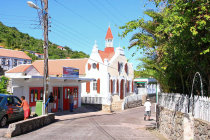
We visited "The Unspoiled Queen". in December 2007. 

website199054.jpg website199053.jpg website199052.jpg website199051.jpg website199050.jpg website199049.jpg website199048.jpg website199047.jpg website199046.jpg website199045.jpg website199044.jpg website199043.jpg website199007.gif website199041.gif website199040.gif
1
2
4
5
6
7
8
9
10
11
12
13
14
15
16
end
website199008.gif website199006.gif
Saba as seem by Google Earth. Note the harbor at Fort Bay bottom left and the airport top right
website199007.gif website199008.gif website199007.gif website199006.gif
view of Cove Bay just outside the airport
3
website199008.gif website199007.gif website199006.gif website199008.gif website199007.gif website199006.gif website199008.gif website199007.gif website199006.gif
the Sacret Heard church in The Bottom is sometimes called Saba's Sistine Chapel
website199008.gif website199007.gif website199006.gif website199008.gif website199007.gif website199006.gif website199008.gif website199007.gif website199006.gif
the Road down to the harbor at Fort Bay was difficult to build, everything was constructed by hand.
website199008.gif website199007.gif website199006.gif website199008.gif website199007.gif website199006.gif website199008.gif website199007.gif website199006.gif website199008.gif website199007.gif website199006.gif website199008.gif website199007.gif website199006.gif website199008.gif website199007.gif website199006.gif website199008.gif website199007.gif website199006.gif
here comes our Sint Maarten bound transportation
website199008.gif website199007.gif website199006.gif
a view of the village of Windwardside
website199005.jpg website199004.jpg website199003.jpg website199002.jpg website199001.gif