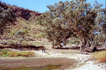
we reach the first pond
that tree has a long way to go
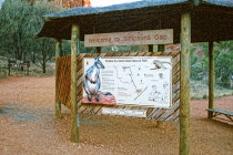
at the entrance there is a small information center
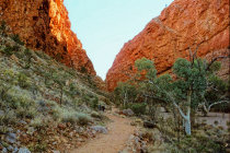
a footpath leads to the Ormiston ponds
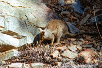
we spot a Rock Wallaby
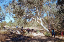
this footpath will bring you to Simpson's Gap
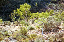
the area sports many young gum trees
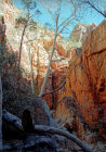
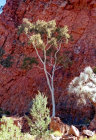
gum trees fill the end of the Gap
Simpson's Gap and Ormiston Gorge
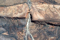
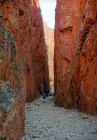
Simpson's Gap in the West Mac Donnell Range was created by waterflows that slowly but surely carved a way through the
solid rock. That was long ago, now Roe Creek gently flows through this very scenic area.
The Gap is a sacred site
for the local Arrernte people who call it Rungutjirpa, the mythological home for ancestral spirits in the form of goannas,
giant monitor lizards.
With Alice Springs close-by, the Gap
draws a lot of (weekend) visitors who hit one of the several trails here.
Making good photos
in the Gap is a real challenge because of huge differences in light level and the dominant red color.
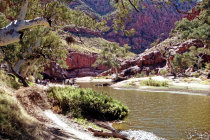
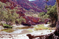
Further to the west in the MacDonell
Range lies Ormiston Gorge that features some scenic permanent ponds, which in the past served as wateringholes for
cattle.
We walked in and out of the Gap and around the Ormiston Gorge watering holes on a clear day in June 1999.


Simpson's Gap as seen by Google Earth. It took a long long time to carve that gap
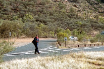
watch out, in Australia they drive on the left side of the road
and it is a gap indeed
in the past it was a watering hole for thirsty cattle
this is the main body of water, tucked away in a scenic setting
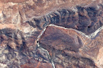
a view of Ormiston Gorge from Google Earth. The black spots are the watering holes
