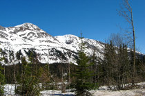
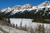
Pine Pass peaks at an elevation of 875 meters. It's end of May but the mountains are still covered in snow
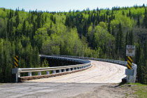
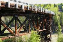
this three-span timber truss bridge over the Kiskatinaw River has a curve of 9 degrees and is 122 m in long
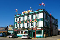
the Alaska Hotel proudly claims to be only 55 paces south of Mile 0
and the Pine River is not ice-free yet
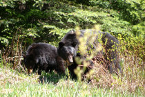
this is number two, just before the family retreats into the bushes
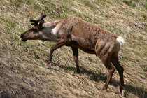
of course we stop for a nice picture of this mature caribou
the new bridge over the Peace River near Taylor. The original bridge collapsed in 1957
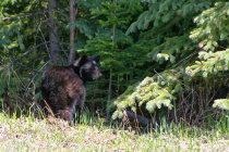
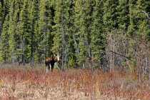
we are being watched
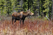
the youngster calmly poses for a nice photograph
from here it is only 2250 km to the official end in Dela Junction
from Prince George to Fort Nelson
The official start of the Alaska Highway is in Dawson Creek but many tourist start at
Prince George as this town is more
easily reached by plane.
So in May 2007 we flew to Vancouver and then to Prince George, also called the Spruce
Capital of British Columbia.
The next morning we picked up the rental car and hit the John Hart Highway 97 north to
start our ALCAN adventure.
At the top of the
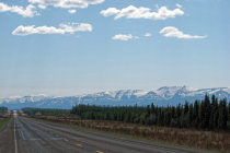
Pine Pass there was still snow on the ground and we enjoyed nice views
of the snow capped Rockies.
From here it is downhill to
Dawson Creek, once a quit farming community before the railway came to
town in 1932.
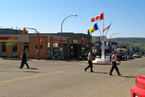
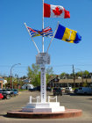
In town you cannot miss the Milestone Zero Marker, inconveniently placed right in the middle of
a busy intersection.
From here Highway 97 goes north to
Fort Nelson, once a fur trading post.Traffic was slow
and we had ample time to stop for any wildlife along the road.
We had nice weather and met a Black Bear family, some
Moose and a Caribou.
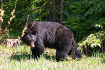


an half hour's drive from Prince George we meet mother Black Bear
and she brought her cubs. This is number one
the official start of the ALCAN in Dalton Creek sits in the middle of a busy intersection
the Kiskatinaw curved bridge sits on an old section of the Alaska Highway. 30 km north of Dawson Creek
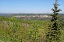
near Fort Nelson we look back to the Rocky Mountains range
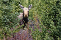
we surprise a young moose