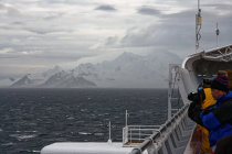
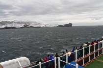
hopefully he brought enough memory cards, because you can keep shooting here
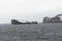
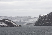
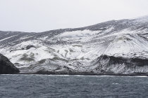
this is Lavebrua Island,named by Norwegian whalers
Mount Kirkwood peaks at 460 meters and is named after Commander Harry Kirkwood
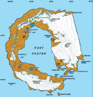
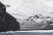
Deception Island is the partly flooded caldera of an active volcano. The last major eruption was in 1969, burying the local cemetery
with fresh lava. Luckily nobody filed a complaint.
The island was explored and named in 1820 by a sealer called
Palmer who was surprised
to find a natural harbor in what looked like just another mountain.
Soon after Deception Island became a major processing
station for seals and whales. The operation lasted till 1930.
Several countries run a research station here. Small ships
can sail into
Port Foster through the windy, narrow and shallow
Neptune's Bellows.
Tourists can inspect the remains of the old
buildings and afterwards take a refreshing dip in one of the hotsprings.
Deception Island is home to several large colonies
of
chinstrap penguins who mainly congregate in the
Baily Head area, where they share the black beach with
several types of seals.
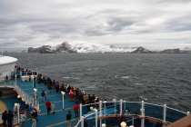
On a cloudy morning in February 2008 we cruised past Deception Island at a safe distance
from the shore, so we could not get a good view of the penguins.
.
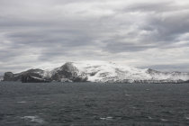
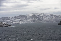


Deception Island. Most of the penguins populate the eastern beaches and flanks of Mount Pond
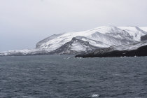
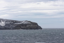
in the morning we approach Deception Island from the south
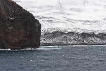
we sail past Entrance Point, gate to Fort Foster. A couple of sailing ships are moored behind Penfold Point
a peak into Fort Foster Bay
we approach Baily Head
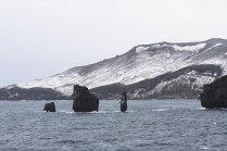
these treacherous rocks are called sewing-machine Needles for good reason

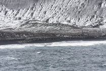
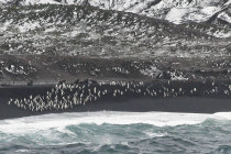
seems like Mount Ford is full of penguin colonies
penguins are good climbers, the dark blob to the upper left is a colony on the flanks of Mount Pond
penguins and sea lions peacefully share the beach
there they are!
we have reached Macaroni Point and are heading into the Drake Passage on our way to Cape Horn
the black beach behind towering Baily Head is supposed to be infested by penguins